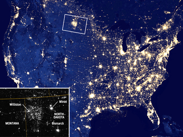
How many times have you thought about looking at North Dakota gas flares from outer space?
Researchers at the University of North Dakota (UND) have, and they’ve recently researched upgraded systems for a more accurate look.

Until recently, nighttime photos of the Bakken area have looked in pictures as bright as major cities—but with no explanation in sight. This made UND professors and graduate students wonder if the cause of the lights was not over-flaring of natural gas from the shale formation, but faulty picture quality.
“Because a typical flare only occupies a 1/6000 fraction of a satellite pixel… any contamination can easily skew the estimate of flares,” said Chris J. Zygarlicke, the deputy associate director for research at UND.
In order to estimate flares more accurately through the satellite images, UND researchers utilized a sub-pixel technique which can detect objects on 22 different spectral bands, from visible to infra-red light. To prove there were inconsistencies in older pictures, they not only used upgraded techniques, but worked with Energy and Environmental Research Center to compare results.
The end goal of this was not only to disprove some of the exaggerated flaring claims, but to more accurately gauge the Bakken area’s environmental footprint and find ways to minimize it in the future.
To read more…


